
COLDER PATTERN ON THE WAY??
/Although the weather has been mild recently, there are some exciting signs showing up on models indicating a pattern change may be on the way! Recently we have been locked into a pattern where a strong ridge has been keeping the area warmer than normal with only brief shots of cooler air and little rain. The good news is (if you like cold weather) this pattern will begin to break down and a new colder pattern will be setting up next week!
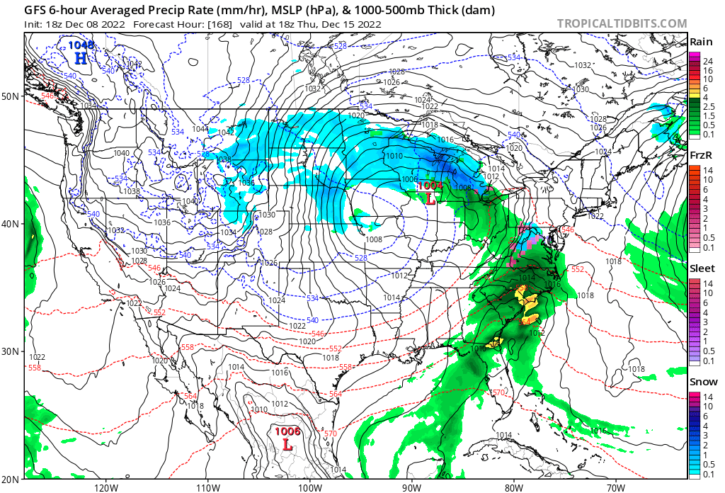
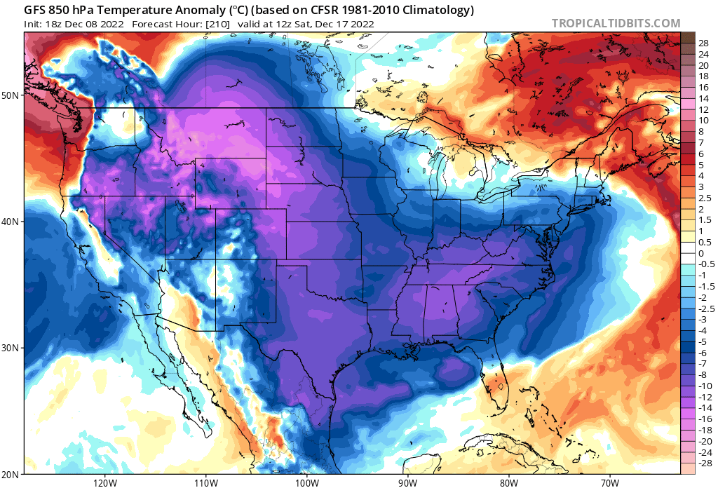
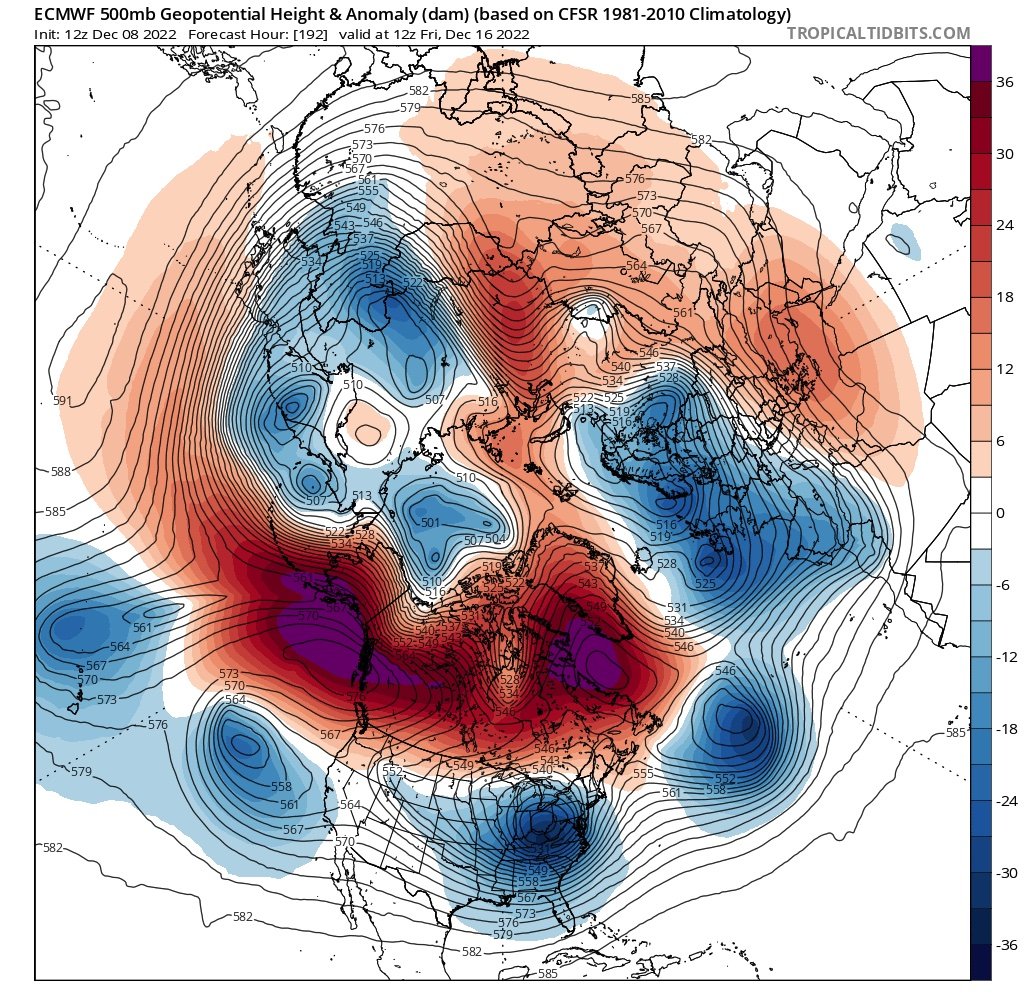
The major system to watch is one that will plow through the Midwest. Locations in the Midwest will deal with snow and wind while areas further south and east will see heavy rain and some strong to severe storms. This system is forecast to set the stage for a much different pattern! Instead of the Southeast Ridge dominating the pattern we will see high latitude blocking setting up that will bring more frequent shots of cold air into the region! The third image in the slideshow below shows the blocking (red colors) in Alaska and near Greenland. This helps to force the colder Arctic air into the United State as seen by the blue colors.
If you love snow, the first thing you want to see is a colder pattern setting up. The pattern we have been in recently is one that is difficult to get any wintry weather in this area. While it remains to be seen how long this new colder pattern will last, signs are pointing to colder weather arriving by the end of next week!