

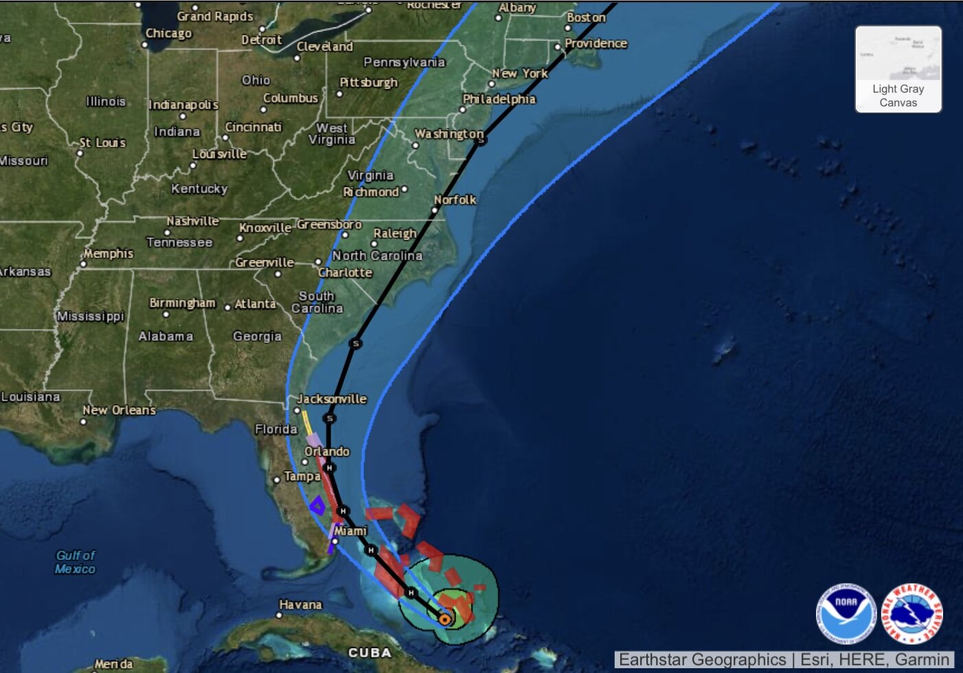
HURRICANE ISAIAS IN THE BAHAMAS
/This evening Isaias has strengthened some with winds now at 80mph. The hurricane hunters are flying through Isaias right now and have found a more organized hurricane. However, shear and dry air will be factors which should limit intensification or slowly weaken Isaias in the next few days.
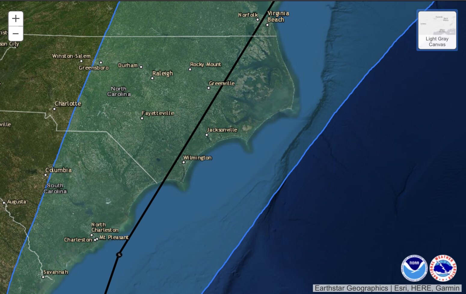
The track has shifted west some this evening. The National Hurricane Center is now forecasting the center to ride up the coast of Florida before making landfall somewhere near Wilmington, NC. The center will then pass over Eastern NC Monday afternoon bringing gusty winds and heavy rain! Of note, some models bring the storm inland over Florida and significantly weaken it with only the remnants moving across the Carolinas.
RAINFALL
The good news is the dry air, shear, and proximity to land should all help keep this system from strengthening much more. The official forecast shows Isaias weakening to a tropical storm by the time it impacts the Carolinas. The worst winds will be north and east of the center and the trough may enhance rainfall amounts across the state. Here is the latest rainfall map.

SUMMARY
Overall the impacts from this system will be fairly minor. Most areas will see 2-4” of rain with some higher amounts possible where the heaviest banding sets up. Along and to the east of the center there will be tropical storm force winds with some power outages possible.
Things can certainly change and we will be sure to keep you updated with any changes to the track or intensity!
Our next update will be tomorrow morning!