

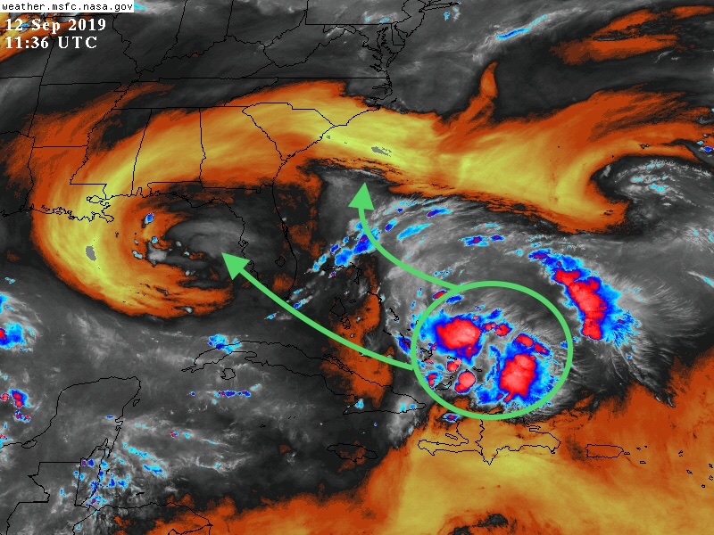
WATCHING THE TROPICS - NEW SYSTEM TO WATCH
/We are full swing into hurricane season and there is a disturbance near the Bahamas that we need to watch closely. The Euro and some other models are moving it just off the coast of Florida and developing it into a powerful hurricane as it sits over or near the warm Gulf Stream waters. Here’s a look at the system below and the cone of possible paths it could take.
Some models like the GFS never really develop it much and take it across Florida then into the Gulf of Mexico. Others like the Euro and ICON develop this system and have it moving up the coast of Florida or just offshore and gradually developing into a formidable hurricane. Here’s a look at the Euro ensembles.
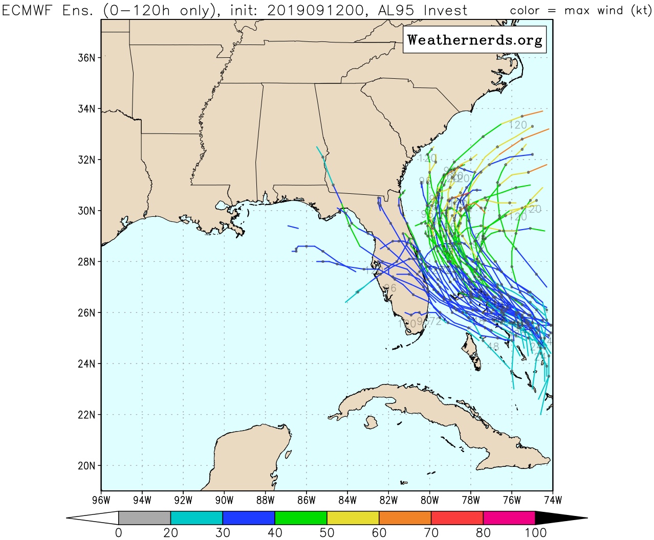
Euro ensembles, courtesY of weathernerds.org
Many of the models have this system recurving or doing a loop/stalling out in this area. It’s a bit too early to tell what this system will do but with it so close to land you will want to watch it closely!