

DORIAN IMPACTING THE CAROLINAS: TORNADO THREAT
/Dorian Now
Winds: 115mph (category 3)
Pressure: 959mb
Weather is starting to deteriorate across the NC coastline this morning. Bands of intense storms are bringing a tornado threat to the area which we will discuss below!
South Carolina is currently see very rough conditions along the coast and inland.


Tornado Threat This Morning
Two bands of storms are currently pushing through coastal sections of NC. These bands have already produced several tornadoes and are continuing to produce them this morning.
The best way to be ready is to stay tuned in to your local forecasters. These tornadoes can pop up extremely fast and we will not be able to cover them.


Impacts
Wind is going to be one of the biggest impacts across the Carolinas.
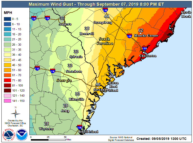
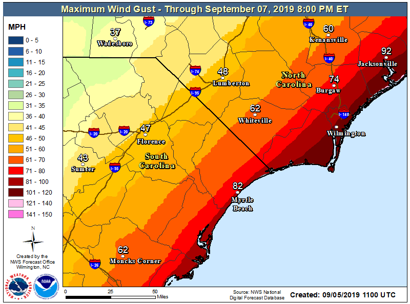
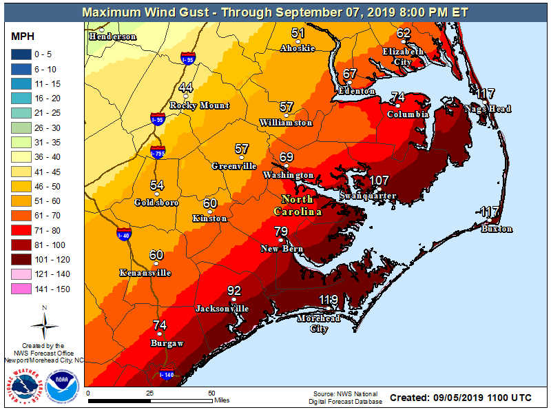
Here are the latest maximum wind gusts (NOT sustained winds) for the Carolinas. These maps are official National Weather Service forecasts.
Coastal NC will see some very rough hurricane conditions this evening as the storm moves in.
Greenville, NC: 51-60 mph wind gusts.
Washington, NC: 61-70mph wind gusts
New Bern, NC: 71-80mph wind gusts (potentially higher)
Beaches: 100+mph wind gusts


Here are some zoomed in images of the wind gust forecasts.
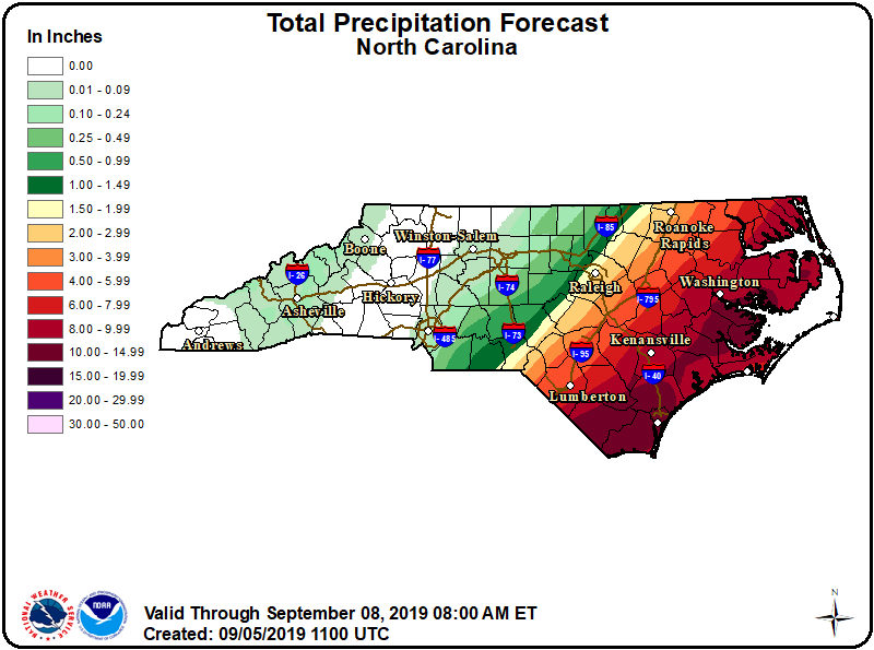
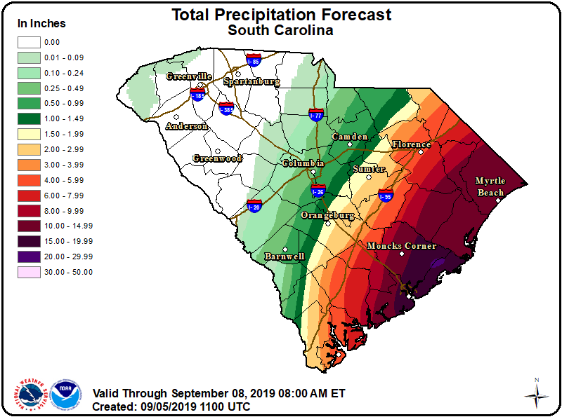
Flooding will also be a major concern for Eastern sections of the states. These tropical rains can dump several inches of rain in a very short time. Be VERY careful out on the roads this afternoon and evening.
This is the official National Hurricane Center rainfall forecast.
This will be our last impacts post. We will begin to post smaller posts dealing with recent reports!